In 2014, the Battle of the Atlantic Research and Expedition Group (BAREG) joined NOAA’s Monitor National Marine Sanctuary and Kara Fox, then an MA candidate in East Carolina University’s Program in Maritime Studies, in a survey of the wreck of the Caribsea, a steamship lost off North Carolina during World War II. Fox and NOAA’s Joe Hoyt served as co-principal investigators, with Ken Kelley as dive master. Dive operations ran from Beaufort, North Carolina, aboard the R/V Cutting Edge over about a week in late May. The survey was part of the larger NOAA “Battle of the Atlantic” expedition, which since 2008 has brought together NOAA, the UNC Coastal Studies Institute and East Carolina University to document the region’s submerged World War II heritage. It was designed as a preliminary baseline assessment: a non-invasive exterior survey meant to produce a site map, record diagnostic features, and document the effects of environmental and human impacts on the wreck.
The Caribsea was built in 1919 as the Great Lakes freighter Lake Flattery and later sailed as the Buenaventura before being renamed Caribsea in 1940. In March 1942, carrying a cargo of manganese ore, it was torpedoed by U-158 about 14 miles off Cape Lookout and sank in under two minutes, with the loss of 21 men. The wreck now sits upright in roughly 85 feet of water. In 1944, the Navy Salvage Service demolished the upper structure to clear a hazard to a shipping lane, and the stern area is badly damaged. Because the site is treated as a war grave, the survey was limited to observation, with no disturbance of the wreck. The baseline data collected were intended to support long-term monitoring and a possible nomination to the National Register of Historic Places.
The research design document can be downloaded below and includes the project schedule, participants and logistics, followed by the survey’s goals and a historical background on the Caribsea, with a period photograph and the ship’s original construction plans. It also covers the scope and limitations of the work, the personnel and equipment, the environment of the site, and the methods the team planned to use, from site plans and photo-mosaics to video documentation and an assessment of the wreck’s long-term preservation. Because it is a planning document, it describes how the survey was set up rather than presenting results, so the final site map is not included.
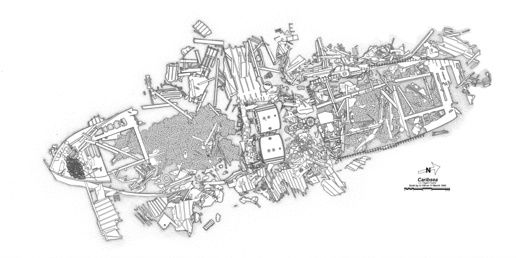
Caribsea Site Plan
